Nearly all of York and Cumberland counties and the entire Casco Bay region are now experiencing extreme drought conditions, according to federal data released Thursday.
The latest map of Maine shows a dramatic expansion of the most drought-stricken part of the state compared with data released a week ago that showed only southern York County in the extreme drought zone. An area designated as being in severe drought, one level lower then extreme, now reaches north to the Bangor region and east to Mount Desert Island and Acadia National Park.
More than 1.05 million Mainers are now living in drought, according to the updated model from the U.S. Drought Monitor, which is 79 percent of the state’s 1.33 million residents.
Also Thursday, the U.S. Department of Agriculture declared that an expanded disaster area now includes Cumberland, Androscoggin, Oxford, Sagadahoc and York counties because of the drought. Farmers within the disaster area will be eligible for assistance from the federal Farm Service Agency, including emergency loans. Farmers in York, Cumberland and Oxford counties got emergency assistance under a more limited disaster declaration earlier this month.
Rainfall has been far below normal this summer. Rainfall in York County since Oct. 1, 2015, has totaled 33 inches, about 16.6 inches below normal, according to the National Weather Service. Sagadahoc and Cumberland counties also have seen about 33 inches of total rainfall, which is 14.6 inches below normal in that part of the state.
And forecasters expect the drought to deepen before there’s any dramatic change in the weather. Some showers are in southern Maine’s short-term forecast, but there is an even chance of above- or below-average precipitation in the next three months, according to the weather service’s Climate Prediction Center.
LOW WATER LEVELS CLOSE TO RECORD
Conditions are the driest in 15 years, and groundwater levels are dropping closer to the lowest point reached during the region’s last serious drought from 1999 to 2002, said Nicholas Stasulis, data section chief for the U.S. Geological Survey in Maine.
Water in a monitoring well in Sanford is a foot above the lowest point measured during that drought, Stasulis said. But groundwater levels typically reach their lowest in the fall, and if the dry weather trend holds, the levels could meet or break those records.
“Even though we haven’t reached the levels we had in the early 2000s, at a lot of our wells we saw the lowest July, August and probably September in the last 20 to 30 years,” Stasulis said. “That would lead us to believe that low levels in October and November would set those records.”
Stream flow data, which goes back more than a century in some cases, may be an even more significant indicator of the drought’s severity than groundwater readings, Stasulis said. Many of the state’s major waterways are considered to be in severe or extreme hydrologic drought, meaning there are only a few days on record with lower water flow measurements. For example, a section of the Saco River in Cornish is lower than 99 percent of readings recorded there over the past 100 years, Stasulis said.
Almost 10 percent of the state, including Cumberland, York and Sagadahoc counties, are in an extreme drought, one step away from exceptional drought, the most serious condition used by the national monitor. Severe drought has spread north and east and now affects most of Androscoggin, Kennebec, Knox, Waldo, Lincoln and Hancock counties. Roughly 18 percent of the state is in a severe drought, up from only 7 percent last week, according to the monitor.
Of the state’s 16 counties, only Aroostook has no areas experiencing drought, although a small portion is abnormally dry.
DESPERATE MEASURES TO GET WATER
Farmers in Maine have been trying to weather the drought by increasing irrigation. The dry weather hurt hay crops in particular and meant some farmers lost second and third cuttings of hay that’s relied on to feed livestock during the winter.

Nina Fuller watches as her sheep head to a pond for water on her property in Hollis. The sheep usually don’t drink from the pond, but because of the drought, that has changed this year, she said. Rainfall in York County since Oct. 1, 2015, is about 16.6 inches below normal. Brianna Soukup/Staff Photographer
Public water sources, which provide drinking water to about 66 percent of the state, have mostly held up, so far, although the York Water District recently contracted with Kennebunk to pipe in water and has asked its customers to limit water use.
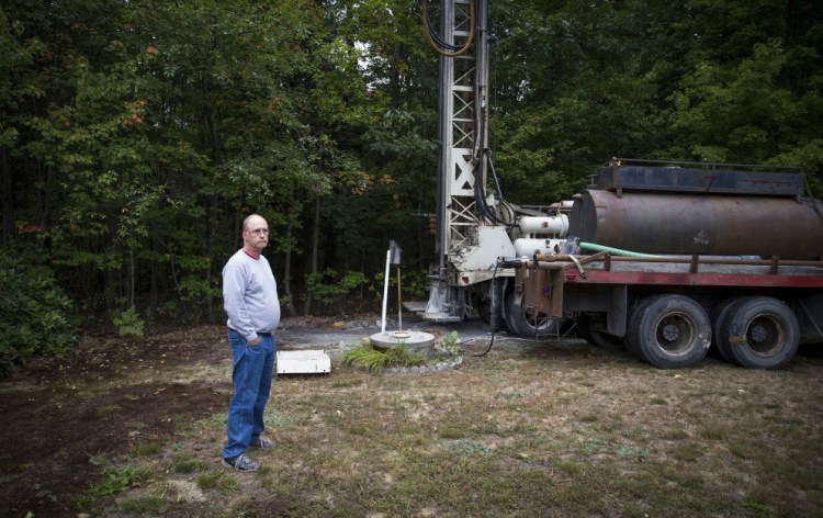
Private well owners, particularly those with shallow dug wells, have been hit especially hard in recent weeks as wells have run dry or are threatening to. Many of those Mainers are limiting water use, and some have resorted to ordering bulk water deliveries or spending thousands of dollars to drill deeper into shrinking groundwater aquifers.
Glen Brand, director of the Maine Chapter of the Sierra Club, said the worsening drought is consistent with extreme weather expected to be brought on by climate change.
“I would not say, ‘Oh, this drought was caused by warming pollution.’ No one could say that with any scientific legitimacy,” Brand said. “But what scientists are telling us is that long periods of drought are one of the manifestations of worsening climate disruption.”
Send questions/comments to the editors.


