When Windham Historical Society holds its open house Saturday, a detailed collection of early maps will be featured. The oldest chart is a hand-drawn depiction from 1771 when Windham was named “New Marblehead,” reflecting those first settlers from Massachusetts. The map shows much of Cumberland County and is a copy of one at the Library of Congress.
What a different landscape those early settlers thought they inhabited. As is often the case with early maps, large land features such as Sebago Lake are misinterpreted. Raymond Neck appears as two large islands rather than the lengthy peninsula it is. Map technology was hampered worldwide until the widespread use of aerial photography after World War I.
The display is largely thanks to the hard work and dedication of society member David Tanguay, a lifelong Windham resident. The town of Windham and society members Norma Rogers, Izzy Gilman and Penny Loura also contributed.
Tanguay has done much research for the society, including extensive study on the Cumberland and Oxford Canal, the early 19th-century waterway of lakes, rivers and locks that linked the wilds of Harrison to Portland Harbor.
“Because of my other projects, I was coming across maps on eBay and other places,” said Tanguay.
Those Internet finds were soon added to what the society already had in its possession and what was available at the town office.
“At one of our committee meetings, we soon realized we had enough material to put together a display,” said Tanguay. “We have over a dozen covering different periods.”
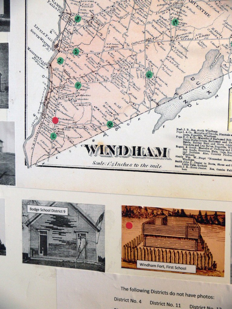
To make the collection more interesting and relevant, the assortment has been broken down into themes, such as school districts, cemeteries and early villages.
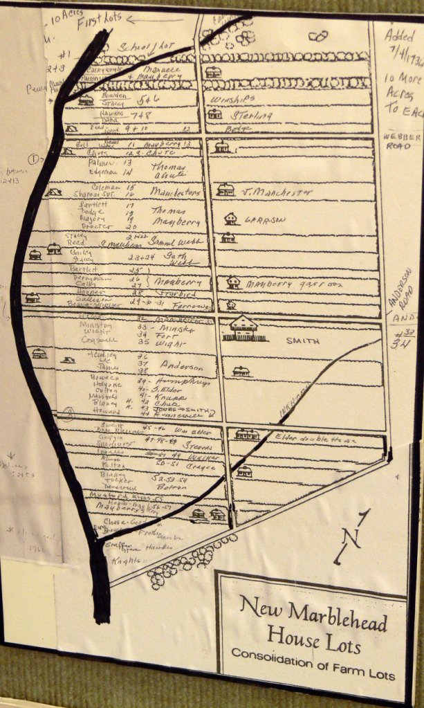
Early maps depict the so-called “Indian lots,” so named because they were from a time when Indian attacks were still a threat. Most towns in the 1700s had a fort or two for protection, and Windham was no exception. The first settlements were in the southern part of town near Westbrook and were situated between the Presumpscot River and River Road.
“The lots were all 10 rods wide and averaged about 10 acres,” said Tanguay. “The theory behind it was to align with a fortification near the Parson Smith House where Anderson Road is today. having these long, narrow lots, people could rapidly run back to the fort during the Indian wars.”
“New Marblehead” lived under the threat of attack well into the 1750s. Many know of the final skirmish in May 1756 when Steven Manchester shot Chief Polin, which effectively brought peace and stability to the area. The story says both were armed with muskets; Manchester apparently reloaded quicker than Polin.
As can be seen in later maps, many of the narrow “Indian lots” eventually were widened and enlarged.
However, Tanguay’s 87-year-old father still lives in South Windham on a 10-rod-wide (165-foot) lot. “So I’ve got some personal interest growing up in this area,” Tanguay said. “I feel town history should be brought out in a contemporary setting so people can see it.”
The maps will be displayed at the historical society headquarters, 234 Windham Center Road, as a self-guided tour. There will be a brochure and people available to answer questions. Copies of certain maps will also be available for purchase.
And just down the road on Saturday, tours will also be provided at the Old Grocery museum, a circa-1820 former grain store and cobbler shop at the intersection of Windham Center Road and Route 202. You can visit new displays of old tools, view canal boat anchors and the original horse drawn hearse that was in use until 1914.
The open house will run from 10 a.m. to 2 p.m. There is no charge, but donations are always welcomed to help the nonprofit society continue its educational work in the community.
Don Perkins is a freelance writer who lives in Raymond. He can be reached at: presswriter@gmail.com
Send questions/comments to the editors.


